You are here
New GRIDDED HYDROLOGIC MODEL OUTPUT Portal Page
In 2012, PCIC launched its Data Portal with the BC Station Data Page, which makes observations from more than 6000 stations available to the public. In the two years since, PCIC expanded our Data Portal, with a High-Resolution PRISM Climatology Page and a Statistically Downscaled Climate Scenarios Page. Now we are expanding our Data Portal again, with our new Gridded Hydrologic Model Output Page, which provides access to gridded, high-resolution projections of hydrologic simulation data for four watersheds in British Columbia, generated at PCIC using the VIC hydrological model.
 |
|
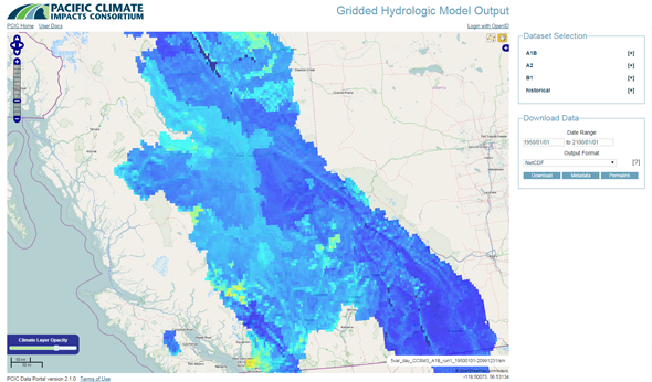
Figure: The user interface of the Gridded Hydrologic Model Output Portal Page. |
Users can sign in to the portal using OpenID and access the snow water equivalent, soil moisture, surface runoff (runoff), subsurface runoff (baseflow), and actual evapotranspiration data for a region covering the Peace, upper Columbia, Fraser and Campbell River watersheds, in three different formats, using an intuitive, map-based web interface.
Learn more about the Gridded Hydrological Model Output Page.
 Twitter
 Facebook
 Google
 LinkedIn